Exeter International Airport (EXT)
City Orientation and Maps
(Exeter, England)
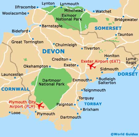
The city of Exeter can be found in the south-west of England, in the county of Devon. Exeter is close to a number of prominent cities, all of which are within easy driving distance. Cities nearby include London (317 km / 198 miles), Bristol (121 km / 75 miles), Plymouth (72 km / 45 miles) and Land's End (193 km / 120 miles). Also nearby are Torquay, Torbay and Paignton, along the south-west coast, and Honiton, to the north-east and close to Exeter International Airport (EXT).
Exeter International Airport (EXT) Maps: Important City Districts
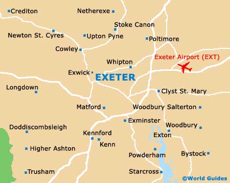
Central Exeter is known for its ancient Roman walls and imposing cathedral, which dominates the city's skyline with its tall square towers. The ruined castle stands to the north, close to the River Exe.
Exeter's redeveloped Quay area has become a particularly popular part of the city and is just a few minutes walk from the centre, being located to the south of the cathedral. Here you will find a number of waterfront attractions, such as bars, restaurants, antique shops and a visitor centre.
The city is dissected by the A377 (Bonhay Road) which runs alongside the river and passes the University of Exeter, to the north. Exeter is home to two busy train stations, the Central Station and St. Davids, just 1.5 km / 1 mile to the north-west of the city centre.
England Map

Devon Map
Exeter Map